Oregon & Washington Coast
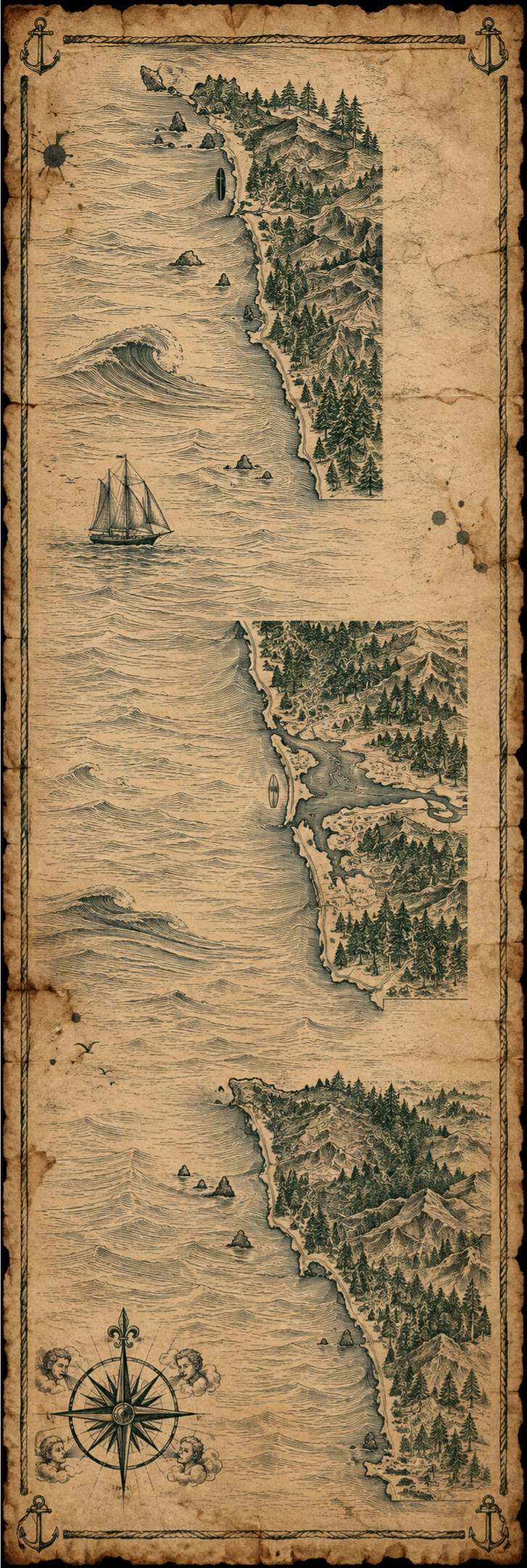
Two things up front, stated together because they're both true. This is not one road trip: Pacific City to Westport is roughly 4.5 hours across a state line, and La Push and Neah Bay sit another 3+ hours beyond that, around the Olympic Peninsula on slow two-lane roads. And this is not mainly a surf trip: the visitor economy here is Haystack Rock, Cannon Beach's arts-town identity, tide pools, and Olympic National Park — surf is a genuine, dedicated local subculture in three hub towns, not the reason people fly into PDX or SEA. Three real hubs — Pacific City, Cannon Beach & Seaside, and Westport — plus La Push and Neah Bay, two sovereign tribal-nation coastlines treated here as hospitality extended to visitors, not as vendor hubs at all. 63 vendors, and the coldest water on the entire US Pacific Coast build to date.

Straight talk: Some links on this page are affiliate links — if you book through them, Secrets of Surf Travel earns a small commission at no extra cost to you. We only link places and people we’d use ourselves, and coverage is never for sale. Those commissions are what keep this site running and fund the next trip.
Some vacation-rental search links on this page (marked “Search Vrbo rentals” or “Search Booking.com stays”) are affiliate links. Every vendor link below is still a plain courtesy link. As more partnerships come online, more links may earn us a commission; the promise above holds either way.
Three hubs, plus two destinations that are genuinely a different category of content. Pacific City is the most surf-forward Oregon hub, home to the historic dory fleet launched straight off the sand. Cannon Beach & Seaside, paired as one hub roughly ten minutes apart, share a surf-instruction bench but carry very different identities — Cannon Beach the arts-town/upscale-inn side, Seaside the boardwalk/family-resort side. Westport, WA is the only Washington hub with a genuine surf-vendor bench, and also a working fishing port. La Push and Neah Bay are noted, not built as hubs — both require tribal-issued access to Quileute and Makah land respectively, and the correct treatment is the dedicated Tribal Access section below, not a vendor table pretending they're the same kind of stop as the other three.
Getting There
Portland (PDX) serves the Oregon hubs — roughly 2 hours to Cannon Beach, a bit longer to Pacific City. Seattle (SEA) serves Westport (about 2 hours 15 minutes) and, at greater distance, the Olympic Peninsula hubs.
- Pacific City to Westport: ~4.5 hours. This crosses the Columbia River into an entirely different state, airport catchment, and lodging market. It is not a day-trip add-on to an Oregon-coast weekend.
- Westport to La Push/Neah Bay: another 3+ hours, around the Olympic Peninsula on two-lane roads through Aberdeen, Forks, and Olympic National Park. Neah Bay and La Push are roughly 1.5–2 hours apart from each other as well — they aren't a matched pair either.
- Practical framing: this is realistically two or three separate trips for most visitors — an Oregon coast trip, a Westport surf trip, and, for those specifically drawn to it, an Olympic Peninsula trip that treats La Push/Neah Bay as a stop within a national-park itinerary, not a surf destination in itself.
- No airport-shuttle option was found for the Seattle–Westport leg — only the PDX–Cannon Beach corridor has a shuttle bench (see Transport & Medical below). State this rather than imply parity between the two coasts.
When to Go & What to Pack
This is the coldest water on the entire US Pacific Coast build to date, and it runs cold essentially year-round — there is no warm season here the way there is south of Point Conception.
- Oregon coast: roughly 48–58°F. A 5/4mm hooded wetsuit with booties and gloves is the baseline, not a winter upgrade.
- Washington coast: roughly 46–55°F, colder still.
- A visitor arriving with a 3/2 or 4/3 from a warmer zone effectively has no trip here.
- Plan for a genuinely rainy, wind-exposed coastal climate most of the year — this isn't a beach-vacation climate in the Southern California sense, even outside the water.
Good to Know (safety)
The most distinctive, safety-critical content on this page — not footnotes. Sourced from NWS Portland/Seattle advisories, Florida Museum of Natural History shark-incident data, and standard Cascadia Subduction Zone public safety materials, stated factually rather than for drama.
Sneaker waves and drift logs — a real, Pacific-Northwest-specific hazard. A sneaker wave runs up the beach dramatically farther than the waves around it, with no warning. The mechanism that makes this coast unusual: large drift logs sitting on the beach — some weighing hundreds of pounds — can be lifted and rolled by a sneaker wave, crushing or trapping anyone caught between the log and the surge. Most visitors from other coasts have never been warned about this specific risk. The National Weather Service offices covering Portland and Seattle issue beach hazards statements and sneaker-wave advisories regularly through fall and winter — multiple were issued across the 2024–2026 seasons — and the standing guidance is consistent: stay well back from the waterline, and never sit or stand on driftwood logs near the surf zone, no matter how solid they look. Documented fatalities occur most years from this exact mechanism.
Tsunami evacuation zones. This coastline sits on the Cascadia Subduction Zone — a roughly 700-mile offshore megathrust fault. Blue-and-white tsunami evacuation route signs are posted throughout coastal Oregon and Washington, in every hub town on this page. A locally generated Cascadia earthquake could send a tsunami ashore within minutes, not hours, which is why the signage points toward “highest ground reachable on foot,” not a distant shelter. This is standard, permanent coastal infrastructure here, stated as logistics rather than alarm.
Remote-coast access facts. Long stretches of both coasts have no cell service. Bluff and headland trails — Ecola State Park, Cape Kiwanda's edges, Neahkahnie Mountain, the Olympic Peninsula coastal trails — carry real fall exposure and deserve the same respect as any exposed cliff trail. Emergency response times away from the three hub towns can run well over an hour. Tides can cut off beach access at points and headlands and strand people who didn't check a tide table — a real, recurring rescue scenario here, not a hypothetical.
Shark incidents — verified, not invented. Two documented, named, dated attacks on this specific stretch: a surfer was bitten off Indian Beach, Ecola State Park (near Cannon Beach) in September 2016 — reported as the first recorded Oregon shark attack since 2013 — and a surfer was bitten off Seaside Cove in December 2020, treated on scene by an off-duty lifeguard with a field tourniquet, non-life-threatening injuries. Oregon's total recorded shark-attack count sits at roughly 28 since 1837 per Florida Museum of Natural History data — a large denominator of time against a very small number of incidents.
La Push & Neah Bay — sovereign nations, not public beaches
This section requires different framing from every other hub on this site: access here is hospitality extended by a sovereign nation, not a public right. No vendor table appears for either place — that's a deliberate editorial choice, not a research gap, and no wave, break, or specific surf location near either reservation is named anywhere on this page, per this site's standing No-Reveal Code and the tribes' own conservation and privacy interests.
Neah Bay — Makah Reservation. A Makah Recreation Pass is required for any recreational activity on the reservation — hiking, camping, kayaking, sport-fishing, and beach/trail visits generally. Per the tribe's own current page (makah.com/attractions/recreation-permits), the pass runs US$20 per vehicle, is valid for the calendar year, covers repeat visits within that year, and must be displayed in the vehicle window. It can be purchased online or at local businesses in Neah Bay. Confirm the current fee directly at makah.com before you go — this figure was current as of this research (August 2026), but tribal fee schedules change without much external notice.
La Push — Quileute Nation. Access rules differ by beach. First Beach requires a day permit (reported at roughly US$10) purchased from the Lonesome Creek Store near the beach, which also covers oceanfront parking. Second Beach requires no tribal pass — access there was settled by a federal land-swap agreement years ago — but the Second and Third Beach trailheads sit inside Olympic National Park, so a park pass (or America the Beautiful pass) applies instead. This is a genuine distinction, not a technicality: don't assume a tribal permit covers every beach at La Push, and don't assume a park pass covers First Beach. This price and rule set needs a final confirmation pass against the Quileute Nation's own current materials at quileutenation.org before you travel — this research relied on third-party trip-report sources for the dollar figure, which is exactly the kind of number that can be out of date by the time you read this.
Framing guidance for visitors. The right posture here is the same etiquette this site asks everywhere, plus an explicit acknowledgment that this coastline belongs to the Quileute and Makah people first. Photography and videography etiquette on Quileute land is a real, stated concern locals ask visitors to observe. Treat both stops as a privilege extended to you, not a beach you're entitled to walk onto.
Respecting the Locals
This coastline belongs to the Quileute and Makah people first — La Push and Neah Bay are sovereign nations, and access there is hospitality extended to visitors, not a public right. Elsewhere along this coast, small towns sit at the end of long, sneaker-wave-and-tsunami-sign stretches of highway, places where the local economy and the local knowledge of this water run deep. The same respect asked of every visitor to tribal land — treating it as a privilege, not an entitlement — is the baseline for how to show up anywhere on this coast.
- Locals get first priority, always. Watch a session before you paddle out. Learn who's who before you learn the wave. Sit inside and catch what they let through — the leftovers are yours, not the set waves.
- Don't backpaddle. Ever. Being in position doesn't make the next wave yours, especially if you didn't wait your turn. If a local wants a wave, let them have it…even if it IS your turn. That older guy who may not be the best surfer out there has probably been surfing that wave before you even sat on a board. If you don't know someone, assume they're local.
- Don't snake. This shouldn't even need to be said, but…dropping in on someone, local or not, is the ultimate disrespect and the fastest way to be sent out of the water. Don't be that guy!
- Say hi. A “howzit,” “whatsup,” or “nice wave,” eye contact, or a nod in the channel — it costs nothing and it's the fastest way from stranger to welcome.
- This is somebody's home, not a resort amenity. The break you're surfing is where a local kid learned to swim, where someone's uncle has surfed for forty years. Act like a guest, because you are one.
- Spend where it actually helps. The food truck, the local shaper, the family-run rental, the local photographer — that's where a surf trip's money should land, not just the chain hotel gift shop. See The No-Reveal Code for why that's the whole premise of this site.
- Leave it better than you found it. Pick up trash that isn't yours. Don't touch reef, wildlife, or cultural sites.
Locals have watched hundreds, if not thousands, of people come and go — some for days, some for months or years — and almost all of them eventually go home. The locals are still there. It takes many, many years to actually become one. Keep that in mind the next time you feel entitled to the same waves they get.
None of this is a secret handshake. It's just how you'd want a guest to act in your own backyard.
Transport
Transport
Honest note: no equivalent shuttle bench was found for SEA → Westport — that leg is drive-your-own or nothing.
- Rose ShuttlePDX ↔ Cannon BeachAirport shuttleDoor-to-door PDX service. roseshuttle.com
- Atlas ShuttlePDX ↔ Cannon BeachAirport shuttleDoor-to-door PDX service. atlas-shuttle.com
- Portland Express ShuttlePDX ↔ Cannon BeachAirport shuttleDoor-to-door PDX service. portlandexpressshuttle.com
Pacific City, Cannon Beach & Seaside
15 surf-specific vendors across these two paired Oregon hubs — genuinely thin next to Southern California zones, and stated as such rather than dressed up. Pacific City and the Cannon Beach/Seaside pair each carry a workable bench of small independent operators. Vocabulary note applied throughout: copy uses “surf guides” and “surf lessons/rentals” only where it's a business's own literal proper name.
Surf Schools
- Moment Surf CompanyPacific City, Cape Kiwanda DrSurf shop, rentals, instruction, ding repairCore shop right on the beach at Cape Kiwanda; demo boards, wetsuit rentals, in-house repair. momentsurfco.com · Map
- Seven SurfboardsPacific City, 33310 Cape Kiwanda DrSurf shop, rentals, instructionRetail shop one block from the beach; boards, wetsuits, instruction. Map
- Leeward Surf — Cape Kiwanda locationPacific CitySurf shop, rentals, instructionFull rental range including kids' gear; instruction for age 5+. leewardsurf.com · Map
- Cannon Beach Surf Lessons & RentalsCannon Beach, Hemlock StSurf guides/instructionSmall-group or private instruction, taught within Ecola State Park — no specific spot named beyond the state park itself. cannonbeachsurflessonsandrentals.com · Map
- Cleanline Surf — Cannon BeachCannon BeachSurf shop, instruction, repair — locally owned since 1980Repair supplies on hand. cleanlinesurf.com · Map
- Cleanline Surf — SeasideSeasideSurf shop, instructionSecond location of the above, same instruction program. cleanlinesurf.com · Map
- Seaside Surf ShopSeasideSurf shop, rentalsBoards, bodyboards, SUPs, wetsuits for all ages. seasidesurfshop.com · Map
- Oregon Surf AdventuresSeasideSurf guides/instructionIn-house instruction partner for Seaside Surf Shop. Map
- NW Women's Surf Camps & Retreats (Lexie Hallahan)Cannon Beach/Seaside areaSurf guides/instruction, CPR-certifiedWomen-focused instruction and retreats. Map
- Art of Surfing (Tony Gardner)Cannon Beach/Seaside areaSurf guides/instruction, CPR-certifiedIndependent instructor, individual/group sessions. Map
Stays
A genuinely rich category, unlike the surf-vendor bench above — real coastal-road-trip lodging in both towns.
- Inn at Cape KiwandaPacific CityHotelOcean-view rooms, walking distance to the beach and dory launch. innatcapekiwanda.com · Map
- Headlands Coastal Lodge & SpaPacific CityHotel/resortOceanfront lodge and cottages, spa on site. Map
- Hart's CampPacific CityAirstreams/cabins/RVDirect access to the beach and Cape Kiwanda State Natural Area. hartscamp.com · Map
- The Cottages at Cape KiwandaPacific CityVacation rental cottagesStandalone cottage cluster near Cape Kiwanda. Map
- Meredith LodgingPacific CityVacation rental managementOceanfront/ocean-view home inventory along this stretch. meredithlodging.com
- Stephanie InnCannon Beach, 2740 S Pacific StBoutique innOceanfront, adults-oriented, 41 rooms with fireplaces. Map
- Surfsand ResortCannon Beach, 148 W Gower AveResortFamily-oriented, near-beach, pool. Map
- The Ocean LodgeCannon BeachHotelWell-known independent oceanfront lodge. Map
- Casago Cannon BeachCannon BeachVacation rental managementLocal rental-management company with area listings. casago.com/cannon-beach
Search Rentals
Food & Drink
Genuine coastal-road-trip food culture, from the original Pelican Brewing to the Cannon Beach/Seaside restaurant bench.
- Pelican BrewingPacific City, 33180 Cape Kiwanda DrBrewpubThe original Pelican Brewing location, right on the beach, view of the dory fleet and surfers. Map
- Tillamook CreameryTillamook, on the drive between hubsFood attraction/diningFree self-guided factory tour and food hall; the single biggest tourism draw between Pacific City and Cannon Beach. Map
- The Wayfarer Restaurant & LoungeCannon BeachRestaurantLocal seafood — Dungeness crab, troll-caught salmon — ocean view. Map
- The BistroCannon BeachRestaurantSmall, candlelit, seasonal PNW menu. Map
- CastawaysCannon BeachRestaurant/barTiki-themed, Caribbean/Creole. Map
- Mo's Seafood & ChowderCannon BeachRestaurantRegional chowder chain outpost. Map
- Ecola Seafood Restaurant & MarketCannon BeachRestaurant/marketFamily-run since the 1990s. Map
- Pizza a'FettaCannon Beach (Hemlock St) & SeasideRestaurantHand-tossed pizza, two locations. Map
- Bagels by the SeaSeasideCafeScratch-made bagels, organic ingredients. Map
Beyond the Surf
Haystack Rock and the dory fleet carry this hub far more than the surf-vendor bench does.
- Cape Kiwanda State Natural Area & the dory fleetPacific CityScenic site/local cultureHome port to 300+ traditional dory boats launched straight off the sand; annual Dory Days Parade. Map
- Haystack Rock Awareness ProgramCannon BeachInterpretive programStaffed at every daytime low tide, March–October; protects the Marine Garden/wildlife refuge at Haystack Rock. haystackrockawareness.com · Map
- Ecola State ParkCannon BeachState park/hiking9 miles of coastline, Tillamook Head, the Lewis and Clark route. Map
- Oswald West State ParkSouth of Cannon Beach, near ManzanitaState park/hikingOld-growth coastal forest, Cape Falcon and Neahkahnie Mountain trails. Map
- Seaside AquariumSeaside, 200 N PromAquariumSmall, family-run, on the Promenade since 1937. Map
- Oregon Coast AquariumNewport — a day-trip distance south of the core hubsAquarium, worth the detourOne of the top-ranked aquariums in the US; a legitimate day-trip mention, not a core-zone stop. Map
Medical
Honest note: Pacific City itself has no hospital — Providence Seaside, roughly 45 minutes north, is the real answer.
- Adventist Health Tillamook — Pacific CityPacific City, 38505 Brooten RdPrimary care clinic, not an ERThe in-town medical option. Map
- Providence Seaside HospitalSeasideHospital, 25-bed, 24-hr ERThe nearest real emergency department to Pacific City and Cannon Beach. Map
- Providence Seaside Walk-In ClinicSeasideUrgent careDaytime/evening/weekend walk-in. Map
Westport
Westport is the deepest bench of the three surf hubs on this coast — the only Washington hub with a genuine surf-vendor bench, and also a working fishing port.
Surf Schools
- Bigfoot Surf SchoolWestport, 2700 Jetty Haul RdSurf guides/instruction, rentalsLong-running Westport school; private/semi-private options. bigfootsurf.com · Map
- Rough Bar Surf ShackWestport, Westhaven State Park areaSurf guides/instruction, rentalsCold-water-specific curriculum: a land safety session before water time; wetsuit/board rental included. roughbarsurf.com · Map
- Steepwater Surf ShopWestport, 316 N. Montesano StSurf shop, rentals, instructionBoard/wetsuit rental and instruction for all levels. Map
- The Surf ShopWestport, 207 Montesano StSurf shop, rentalsIndependent shop, board/gear rental. Map
- Gravity Haus WestportWestportSurf hotel/camp — lodging + instruction + rentalsHybrid lodging-and-instruction operation; on-site rentals. gravityhaus.com/locations/westport · Map
Stays
Real lodging in Westport plus Grayland, just south of it.
- Westport Inn CabinsWestportCabinsIndependent cabin lodging. Map
- Dock Street InnWestportInnSmall independent inn near the marina. Map
- South Bay InnWestportInnIndependent lodging. Map
- Grayland Surf CottagesGrayland, adjacent to WestportCottagesAffordable surf-trip cottages just south of Westport. graylandsurfcottages.com · Map
- Breakwater ResortGrayland, 10 min south of WestportResort7-acre beachfront property, cabins and houses. Map
- Ocean Spray Beach ResortGraylandCottagesBeachfront cottages, short walk to the beach. Map
Search Rentals
Food & Drink
Westport's working-port seafood markets and diners.
- Blue Buoy RestaurantWestport marinaRestaurantFamily-owned marina diner, known for its Dungeness crab omelet. Map
- Bennett's Fish ShackWestportRestaurantLocal fish-and-chips standby. Map
- Merino's Seafood MarketWestportSeafood marketFresh local-caught seafood, walk-up fish-and-chips window. Map
- Westport SeafoodWestport, 609 E Neddie Rose DrSeafood market/restaurantMarket, chowder, fish-and-chips. Map
- Brady's OystersWestportSeafood marketLocal oyster source. Map
Beyond the Surf
A working salmon port with real maritime history to go with it.
- Grays Harbor Lighthouse (Westport Light)WestportHistoric siteTallest lighthouse in Washington (107 ft), climbable, original Fresnel lens. Map
- Westport Maritime MuseumWestportMuseumMaritime history of South Beach; runs lighthouse tours. Map
- Westport Light State Park & Westhaven State ParkWestportState parksConnected by boardwalk/dune trail; the 6.5-mile Maritime History Trail links to the marina. Map
- Ocean Sportfishing (whale watching)Westport, 2549 Westhaven Dr, Float 12Whale-watching charterTwice-daily gray whale trips, March–May migration. Map
- Westport charter fleet (Deep Sea Charters Inc., Tommy Cod Charters, others)Westport marinaFishing charters“Salmon Capital of the World” — a genuine working-port identity, not a marketing line. Map
Medical
- Harbor Regional Health / Grays Harbor Community HospitalAberdeen, WA, 915 Anderson DrHospitalNearest hospital-level care to Westport, about 20 minutes away. Map
La Push & Neah Bay
No surf-vendor table appears for La Push or Neah Bay by design — both are sovereign tribal land, covered above in the dedicated Tribal Access section, not built as a vendor hub. This entry carries the one on-the-way stop most readers heading toward either place will actually pass through.
Beyond the Surf
- Hoh Rain Forest Visitor Center (Olympic NP)Forks, WA, 18113 Upper Hoh RdNational park visitor centerThe gateway most readers heading toward La Push/Neah Bay will actually pass through. Map
Local Secrets
Four things about this zone that change how your trip actually runs.
- Pacific City's dory fleet is a genuine working tradition, not a tourist recreation Ongoing, unique to this stretch of coast
Over 300 flat-bottomed boats still launch straight off the sand, a practice unique to this stretch of the Oregon coast.
- The Haystack Rock Awareness Program is a rare, free, hands-on marine-science stop Staffed at every low tide, March–October
Volunteers and interpreters staff the site at every daytime low tide in season — most visitors don't know to look for it.
- Westport's “Salmon Capital of the World” identity is a working-port fact, not a slogan Ongoing
The charter fleet and the surf community share the same small marina.
- Tillamook Creamery functions as the de facto rest stop for the whole road trip On the drive between Pacific City and Cannon Beach
Technically inland of the coast highway, but it belongs in the road-trip narrative even though it isn't beachfront — nearly everyone driving this corridor stops here.
Questions people actually ask.
Is Oregon/Washington a real surf destination?
Locally, yes — there's a genuine, dedicated, cold-water surf culture in all three hub towns. As a visitor draw, no — most people come for the coastal scenery, small towns, and, in Washington, the national park and tribal lands. Surf is a real thread, not the headline.
Do I need a wetsuit even in summer?
Yes. Water stays in the high 40s to high 50s °F essentially year-round. A 5/4 hooded suit with booties and gloves is standard gear here, not winter-only gear.
Can I just show up and surf at La Push or Neah Bay?
No. Access to both requires a tribal-issued pass or permit, and different rules apply beach by beach. Check the tribe's own current site (makah.com for Neah Bay; the Quileute Nation's own materials for La Push) before you go — this is sovereign land, and the requirements can change.
Is Pacific City to Westport a good day trip?
No — budget it as its own leg. It's roughly 4.5 hours of driving between two different states and airport regions.
What's a sneaker wave, and why does it matter here?
A sneaker wave runs up the beach dramatically farther than the waves around it, with no warning. The specific mechanism here: large drift logs on the beach can be lifted and rolled by the surge, crushing or trapping anyone caught between the log and the water. Stay well back from the waterline, and never sit or stand on driftwood logs near the surf zone.
Disclosure & how this page works.
Straight talk: Some links on this page are affiliate links — if you book through them, Secrets of Surf Travel earns a small commission at no extra cost to you. We only link places and people we’d use ourselves, and coverage is never for sale. Those commissions are what keep this site running and fund the next trip.
Today, the “Search Vrbo rentals” and “Search Booking.com stays” links on this page are affiliate links — every vendor listing link is still a plain courtesy link. Agoda links for this zone are pending a partner hid and are not yet live. As partnerships with these local businesses come online, more links may earn us a commission, and this page will keep saying so plainly. Coverage is never for sale: nobody on this page paid to be here, and nobody can.
Where this page is deliberately thin, and why. 63 vendors total, but only 15 are surf-specific — schools and shops across Pacific City, Cannon Beach/Seaside, and Westport — roughly a fifth the density of a strong Southern California zone. That's the honest state of this coast's surf-tourism market, not a padding failure. No “Map” link above is a hand-verified pin — every one is a constructed Google Maps search query built from the vendor's name and town, stated here as this page's Maps-link convention. La Push and Neah Bay carry zero vendor entries by design; both are sovereign tribal land, covered in their own dedicated section rather than a vendor table. Tribal permit fees stated above (US$20/vehicle/year for Makah; roughly US$10/day for Quileute First Beach) came from the tribe's own current page in the Makah case and from third-party trip reports in the Quileute case — both carry an explicit “confirm current rate” note baked into the copy, not just here. No shuttle bench was found for the Seattle–Westport leg; only PDX–Cannon Beach has one, stated plainly rather than implying parity.
Every listing was researched in 2026 and is being verified in person. Prices, hours, and policies change — treat them as strong starting points and confirm directly with the business, and for the tribal permit fees above, confirm directly with the tribes themselves before you travel. And per the No-Reveal Code: you will find no surf spots on this page, ever — and no wave, break, or specific surf location near La Push or Neah Bay, named or described, anywhere on this page.